

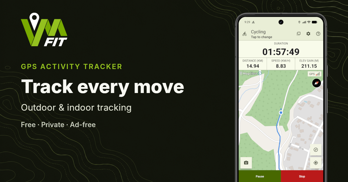
A GPS activity tracker records where you travel during an outdoor activity and turns those location measurements into useful information such as distance, route, speed and pace.
GPS tracking is commonly used for running, walking, cycling and hiking. It can show where an activity took place, how long it lasted and how performance changed along the route.
Although these apps are often called GPS trackers, modern phones may use several satellite navigation systems together to determine their location. The basic process remains the same: the device measures its position repeatedly while the activity is in progress.
| Stage | What happens |
|---|---|
| Positioning | The phone or watch calculates its location from satellite-navigation signals |
| Recording | The application collects a sequence of location points and timestamps |
| Processing | The tracker calculates distance, duration, pace, speed and other statistics |
| Review | The completed route and measurements are presented in an activity summary |
What does a GPS activity tracker record?
A GPS activity tracker normally records a sequence of location updates.
Each update may contain information such as:
- Latitude and longitude.
- The time the location was measured.
- An estimated accuracy value.
- Device-reported altitude, when available.
- Device-reported speed, when available.
- Direction of movement, sometimes called bearing.
One location update provides only a position at a particular time. A sequence of updates creates the recorded route.
From these locations and timestamps, the activity tracker can calculate statistics such as:
- Total distance.
- Activity duration.
- Current and average speed.
- Current and average pace.
- Estimated elevation gain and loss.
- Distance splits or laps.
The application may also produce additional estimates, such as calories or hydration requirements. These values can depend on the selected activity, application settings and other information rather than GPS measurements alone.
The exact measurements available depend on the application, device, activity type and quality of the recorded location data.
How does GPS determine your location?
Satellite-navigation systems transmit precisely timed navigation signals. A phone or watch receives signals from multiple satellites and uses them to calculate its position.
Although the term GPS is commonly used for satellite positioning in general, modern devices may combine several Global Navigation Satellite System constellations, including GPS, Galileo, GLONASS and BeiDou.
Access to more satellites can help the device establish a position more quickly or maintain a more reliable result when part of the sky is obstructed.
The activity-tracking application does not communicate with the satellites directly. It requests location updates from the operating system and processes the measurements provided by the device.
How does the tracker create a route?
When an activity starts, the tracker begins collecting location updates.
Each accepted point is added to the previous points. Connecting them creates the line shown as the activity route on a map.
A long activity may contain hundreds or thousands of points, depending on its duration and how frequently the device provides new locations.
The resulting route is an estimate rather than a perfect reconstruction. Buildings, trees, terrain, reflected signals and poor satellite visibility can move individual points away from the actual path.
The application may filter inaccurate or implausible points before including them in the route and its calculations.
How is distance calculated?
Distance is estimated by calculating the distance between consecutive accepted location points and adding those measurements together.
For example, if the tracker records three movements of 20 metres, 35 metres and 15 metres, the accumulated distance becomes 70 metres.
The calculation becomes more complicated when some location points are inaccurate. A point that suddenly jumps to the other side of a road could add distance that was never travelled.
Activity trackers may therefore apply filtering to reject or reduce the effect of unreliable measurements. The quality of this filtering can influence the final recorded distance.
What is the difference between speed and pace?
Speed and pace describe movement in different ways.
Speed shows how much distance is covered during a period of time. It is commonly used for cycling and may be displayed in kilometres per hour or miles per hour.
Pace shows how much time is required to cover a unit of distance. It is commonly used for running and walking, such as minutes per kilometre or minutes per mile.
They describe the same movement from opposite directions:
- Higher speed means faster movement.
- Lower pace means faster movement.
A GPS activity tracker calculates these values from recorded distance and time. Current speed or pace can fluctuate more than the overall average because it is based on a shorter section of the route.
How are elapsed time and moving time different?
Elapsed time is the complete period between starting and finishing an activity.
Moving time attempts to exclude periods during which the user was stationary.
For example, a run may contain 30 minutes of movement and three minutes spent waiting at road crossings:
- Elapsed time: 33 minutes.
- Moving time: approximately 30 minutes.
Some activity trackers use auto-pause to stop the active timer when movement falls below a configured threshold. Others continue recording and calculate moving time after the activity.
The two measurements answer different questions. Elapsed time shows how long the complete activity took, while moving time focuses on the periods of movement.
For a more detailed comparison, read Elapsed time vs moving time: what is the difference?.
How does a tracker measure elevation?
A device may provide altitude as part of its location measurements. Some phones and watches also contain a barometric pressure sensor, while applications may use terrain data or an external elevation service to improve the completed result.
GPS altitude is usually less precise than horizontal location. Small changes in the recorded altitude can therefore accumulate into unrealistic elevation gain or loss.
An activity tracker may smooth the altitude data or apply corrections to reduce these fluctuations. Even then, elevation should be treated as an estimate, particularly when the route contains only small climbs and descents.
Elevation data is most useful when considered together with the route and overall terrain rather than as an exact survey measurement.
Does GPS activity tracking require an internet connection?
Receiving satellite location signals does not inherently require mobile data or Wi-Fi. A compatible phone can normally determine and record its location while offline.
However, some related functions may require internet access, including:
- Downloading map tiles.
- Loading weather or environmental information.
- Synchronising activities with an online account.
- Sharing an activity.
- Uploading data to another service.
This means an app may be able to record the route without internet access even when its online maps or connected services are unavailable.
You can read more in Can you track running, walking and cycling without internet?.
What affects GPS tracking accuracy?
GPS accuracy varies with the device, surroundings and current conditions.
Common factors include:
Buildings
Tall buildings can block or reflect satellite signals. This is especially common in dense city streets, where the recorded route may move between opposite sides of the road.
Trees and terrain
Forests, steep valleys, cliffs and mountains can reduce the visible part of the sky and limit the number of usable satellites.
Device placement
A phone inside a deeply covered bag or surrounded by other objects may receive weaker signals than a phone carried with a clearer view of the sky.
Initial location fix
Starting an activity before the device has established a stable location may produce inaccurate points near the beginning of the route.
Battery and background restrictions
Device-specific battery controls can delay or interrupt location updates while the application is not visible.
Before relying on a tracker for a long activity, test that recording continues correctly while the screen is off and review any battery restrictions applied to the application.
Movement speed
Slow or irregular movement can be harder to distinguish from normal GPS position drift. This is one reason tracking settings suitable for cycling may not be appropriate for walking.
GPS activity tracking is therefore best understood as a practical measurement system rather than a source of perfectly exact coordinates.
For a detailed explanation of route drift, signal obstruction and differences between devices, read How accurate is phone GPS for outdoor activity tracking?.
Can a phone replace a dedicated GPS watch?
A modern phone can provide effective GPS tracking for many outdoor activities. It already contains the required satellite receiver, processing power and storage.
A dedicated watch may be more convenient when you want to view information directly on your wrist or avoid carrying a phone. Some watches also include additional sensors such as heart-rate monitors and barometric altimeters.
The better choice depends on the activity and the features you need.
Phone-based tracking can provide:
- A larger screen and map.
- Easier route review.
- More storage.
- Direct access to sharing and export tools.
- No requirement to purchase a separate tracking device.
A watch can provide:
- Easier access to live information.
- Convenient workout controls.
- A smaller device to carry.
- Additional sensor measurements on supported models.
Some systems combine both approaches. The phone performs the main recording while a connected watch provides controls and live workout information.
Which activities can be tracked with GPS?
GPS tracking works best for activities that involve movement across a route.
Common examples include:
- Running.
- Walking.
- Hiking.
- Road cycling.
- Mountain biking.
- Cycle touring.
- Other route-based outdoor activities.
Different activities need different interpretations of the same location data.
A cyclist may focus on speed and elevation. A runner may focus on pace and distance splits. A hiker may care more about route, elevation and total elapsed time.
A useful activity tracker adjusts its presentation and behaviour to match the selected activity rather than treating every workout identically.
What happens after the activity finishes?
After recording stops, the tracker processes the collected information into an activity summary.
This may include:
- A map of the completed route.
- Total distance and duration.
- Average and maximum speed.
- Average pace.
- Elevation gain and loss.
- Laps or distance splits.
- Graphs showing changes during the activity.
- Weather or environmental context, when supported.
Reviewing the summary can reveal information that was difficult to notice while moving.
For planning before a route begins, see What weather conditions should you check before an outdoor activity?.
Distance splits may show where pace changed. Elevation can explain slower sections. The map may reveal an unexpected detour or an inaccurate part of the route.
Over time, completed activities provide a history that can be used to compare routes, distances and performance.
GPS activity tracking with VMFit
VMFit is an Android GPS activity tracker for supported outdoor activities.
The Android phone performs the primary activity recording. During an activity, VMFit can record the route and display live information such as distance, duration, pace or speed.
After the activity, the recorded information can be reviewed through the route, statistics, interactive graphs and distance splits.
VMFit also supports:
- Configurable auto-pause by activity type.
- Laps and distance splits.
- Highlighted lap sections on the route.
- Conditions information, including weather and environmental data.
- A Wear OS companion app for workout controls and live information.
Activities are stored locally on the Android phone, and VMFit does not require an account to begin tracking.
Read Can you use a fitness tracker without an account? for more information about local-first activity storage. The development history behind these choices is described in From GPS Track to VMFit: The Story Behind the App.
Frequently asked questions
What is a GPS activity tracker?
A GPS activity tracker is an app or device that records a sequence of locations during an activity and uses them to calculate the route, distance, speed, pace and other measurements.
Is a fitness tracker the same as a GPS tracker?
Not always. A fitness tracker may focus on steps, heart rate or daily movement without recording a route. A GPS activity tracker specifically uses location data to track movement across an outdoor route.
Can a phone track running accurately?
A phone can provide useful running distance, route and pace measurements. Accuracy depends on the phone, satellite visibility, surroundings, device placement and how the app processes the recorded points.
Does GPS work without a SIM card?
Satellite location does not require a SIM card. A phone may still record a GPS route without mobile service, although maps, sharing and other online functions may be limited.
Does GPS tracking use mobile data?
The location measurement itself does not require mobile data. Loading online maps, weather information or connected services may use data.
Why does my recorded route move away from the path?
Buildings, trees, terrain and reflected satellite signals can reduce accuracy. Individual recorded points may then appear beside the actual route.
Does GPS tracking consume battery?
Yes. Repeated location measurements, screen use, maps and additional sensors consume battery. The amount depends on the device, tracking duration and application behaviour.
Conclusion
A GPS activity tracker turns a sequence of satellite-based location measurements into a route and useful activity statistics.
By combining location, distance and time, it can show where you travelled, how far you went and how your pace or speed changed. The result is not perfectly exact, but it provides a practical way to record, review and compare outdoor activities.
VMFit uses this process to track running, walking, cycling and hiking while keeping the recorded activity available locally on the Android phone.